
Virginia Winery, Cidery and Meadery Map-Folded
Item#: C2001
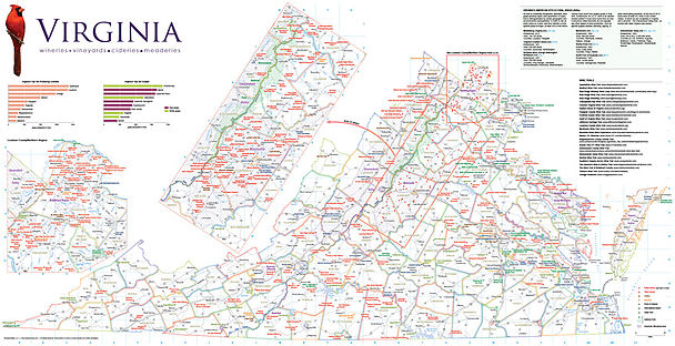
• Newly revised for 2016, including a new inset of Loudoun County/Northern Virginia - the region with the greatest density of wineries in Virginia - and revised ratings of top producers.
• This revised edition now depicts more than 260 wineries, cideries, and meaderies, addresses, phone numbers, hours of operation, and GPS coordinates to make finding hard-to-find wineries easier.
• Other highlights include comprehensive information on all seven of Virginia's American Viticultural Areas (AVAs), and charts depicting Virginia's top wine grapes and wine grape producing counties.
• The map includes Virginia's national and state parks, universities, and notable points of interest such as Monticello and Busch Gardens, among others.
Overall map size: 19 x 37 inches (48.26 x 93.98 cm)
Folded size: 3.8 x 9.25 inches (9.65 x 23.50 cm)